Washington County, Rhode Island Zip Codes
Washington County is located in Rhode Island. The county seat is West Kingston. It encompasses 333 square miles of land area and 52 square miles of water. The county has an estimated population of 133,801 and contains 0 zip codes.
All Washington County Zip Codes
| ZIP Code | City | County | Population | Type | Details |
|---|
Washington County ZIP Code Map


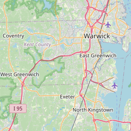
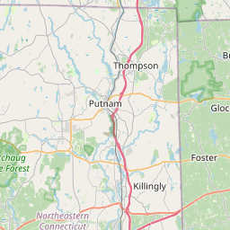
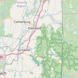

Map of all zip codes in Washington County, Rhode Island.
Cities in Washington County
Washington County Demographics
Population and demographic data sourced from the U.S. Census Bureau American Community Survey (ACS) 2024 5-Year Estimates. ZIP code routing data sourced from the United States Postal Service (USPS).
All demographic data on this page is sourced from the U.S. Census Bureau American Community Survey (ACS) 2024 5-Year Estimates via Census Reporter. ZIP code boundary and delivery data is sourced from the United States Postal Service (USPS). Data is updated periodically and may not reflect the most current figures. ZIP Code Tabulation Areas (ZCTAs) used for census-level data may differ slightly from USPS ZIP code boundaries.